McConnell
Lake
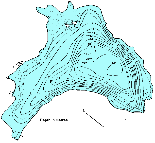
Click
on the lake icon at the right to see full bathymetric map.
Click on the moose on the left for complete BC travel information.
Location:
From Kamloops travel west onto
the Trans Canada (hwy#1) for 11.4 km. (7.1 miles). Turn south on
the Coquihalla hwy (hwy #5). Take exit 336 off of hwy 5 and drive
northeast on the Lac le Jeune road for 9.6 km. (6 miles). Turn right
to McConnell Lake boat launch.
Resorts
& Campsites:
No resort on the lake, however, there are resorts on the nearby
Lac la Jeune and Walloper lakes. There is a camping and picnic area
at the boat launch.
BC Adventure Network members serving this area:
If you would like to have your business listed, please Click Here.
Fishing
Report: A rainbow stocked lake with an abundance of insect
and shrimp life offering fair catches of trout up to the 2 lb. range.
Trolling and spinning gear are the most popular methods used here
while fly fishers concentrate their efforts mainly on the shoal
located along the east side of the lake. Be sure to visit Fishbc.com
for angling information!
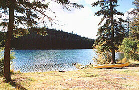
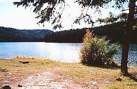
Viewscape:
McConnell Lake was situated in a glacial outwash channel on the
Nicola Plateau, part of the Interior Plateau physiographic region.
The basin of the lake was likely a depression left by the melting
of a dead ice block during deglaciation. Surrounded by gentle rolling
hills covered in mainly engelmann spruce, douglas fir, lodgepole
pine and occasional alpine fir. Patches of aspen, bunchgrass meadows
(with occasional ponderosa pine and sage) are found on the slopes.
Willows are found in the low-lying wetlands.
Shoreline:
The west side has a steep drop-off from the waterline but along
the east side and bays the drop-off from the shoreline is very gradual.
Most of the shoals are silt with cobbles except for the area immediately
around the islands and just off the more acute points which are
entirely covered in pebbles. Many areas of shoreline are bushy with
a fringe of willows and water birches.
Nearby
Lakes
Lodgepole
- Lodgepole, a small lake (6.5 ha/16 acres) is located just to
the west of McConnell (west off hwy 5). It is a stocked lake which
offers a fine rainbow fishery, up to 2 lbs. Elevation is 1433
m. (4700 ft.) so fishing is good through the hot summer months.
Located on Lodgepole lake is a 10 vehicle BCFS campsite with boat
launching (electric motors only).
Note:
Always check your current BC Fishing regulations before you start
fishing a new lake.